Quiz: How Well Do You Know Australian Place Names?
Ever heard of Dismal Swamp? Is there any point to Useless Loop? See if you can tell which places really exist in Australia, and which are the ones we've made up. Take our quiz now and then read on to learn more about some of the country's most unique spots.
Only scroll down once you've completed the quiz!
Dismal Swamp
The Tarkine, Tasmania
Where is it? A 32-kilometre drive south-west of Smithton on the Bass Highway.
How’d it get the name? Dismal Swamp is a giant sinkhole – the largest in the Southern Hemisphere – filled with ancient blackwood trees that thrive in the swampy conditions at the bottom. It was named in 1828 by government surveyor John Helder Wedge, who apparently experienced a dismal night there when he and his party were forced to sleep in trees and on fallen logs to stay dry.
What’s it really like? More magical than dismal, it’s a curious mix of theme park, nature reserve and art gallery. From the top of the sinkhole, you can follow the walkway, take the buggy or shoot down a curvy 110-metre slide (that’s the theme-park bit). At the bottom, four meandering boardwalks wind through the forest (the nature side). Sculptures and other works by local artists are on display throughout the site and it’s all a bit Alice in Wonderland as you stumble across trees with eyes, pop-up crayfish and alien swamp creatures.
Not to be confused with: Mouldy Hole, also in Tasmania, or Dump Beach in South Australia.
Banana
Banana shire, Queensland
Where is it? A 150-kilometre drive south-west of Rockhampton.
How’d it get the name? Banana has nothing to do with fruit and everything to do with cows. Formerly known as Banana’s Gully, the town (and the surrounding Banana Shire) was named in honour of a dun-coloured bullock called Banana, prized by local stockmen for his ability to herd wild cattle into holding yards. Banana died in the 1860s but there’s a life-size statue of him beside the Dawson Highway in town.
What’s it really like? Banana is your quintessential small Queensland farming town. Just don’t expect to feast on locally grown bananas – the tourism folk concede there isn’t a single banana tree in sight. The cows are fine and the fishing is good.
Not to be confused with: Orange or Big Raspberry, both in NSW, or Cream Puff Corner in South Australia.
Devils Kitchen
Tasman Peninsula, Tasmania
Where is it? A 90-kilometre drive east of Hobart.
How’d it get the name? Robert Pennicott, who runs adventure cruises around the peninsula, says the name harks back to convict times. “On a rough day the sea smashes into cliffs and from above it looks like a big cauldron on the boil,” he says. “The soldiers and superintendents from Port Arthur, probably after a few drinks of rum, called it Devils Kitchen.”
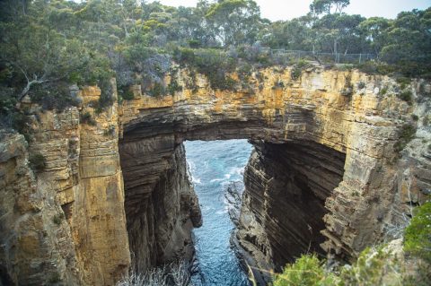
What’s it really like? It’s a 60-metre-deep cleft carved into a cliff by an often furious sea. While not particularly devilish (“On a calm day it’s beautiful,” says Pennicott), it’s certainly dramatic and one of several spectacular rock formations within proximity in Tasman National Park. These include the Tessellated Pavement (a stretch of coastline resembling giant tiles), the Tasman Blowhole and the ruins of once-huge sea caves at Tasman Arch. All are just a short drive from the World Heritage-listed penal settlement at Port Arthur.
Not to be confused with: Hells Gates, also in Tasmania, Lucifers Thumb in NSW or the Devils Marbles in the Northern Territory.
Mount Misery
South Gippsland, Victoria
Where is it? Near Outtrim, a 130-kilometre drive south-east of Melbourne.
How’d it get the name? Although none are really high enough to qualify as mountains, there are several Mount Miserys around the country, proving that most of our early explorers and hikers were a glass-half-empty lot when it came to slogging up steep hills, such as this 263-metre-high pile of unhappiness in Victoria’s South Gippsland.
What’s it really like? One person’s misery is another’s delight. “It’s a great challenge for us crazy cyclists starved for long hill climbs in the foothills area of the Strzelecki Ranges,” says Mark Bensley, president of the Leongatha Cycling Club. “It’s our club’s annual hill-climb event. There are nice views of Wilsons Promontory on a good day.”
Not to be confused with: Misery Knob in Tasmania or Funk Gully in Queensland.
The Edge of the World
The Tarkine, Tasmania
Where is it? A 90-minute drive south-west of Stanley.
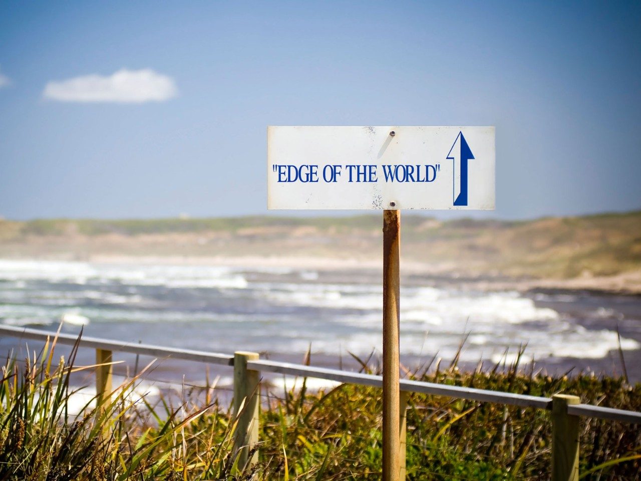
How’d it get the name? The Edge of the World is a lookout at the mouth of the Arthur River with nothing between it and the nearest landfall west – Patagonia in South America – except 20,000 kilometres of ocean swells. It’s the longest uninterrupted expanse of ocean on the planet. The name was coined by Tasmanian tourism pioneer Brian Inder, who penned a poem about the wild, windswept coast (“I cast my pebble onto the shore of Eternity…”), which you can read on a plaque near the lookout.
What’s it really like? The locals have a saying in north-western Tassie: “If the wind stopped blowing, the cows would fall over.” The Edge of the World is a lonely, wave-battered place on the periphery of the Tarkine rainforest, where the wind blows so powerfully some days that it feels as though it could knock you off your feet. But at least it’s the cleanest air in the world, according to the boffins who measure these things at nearby Cape Grim Baseline Air Pollution Station.
Not to be confused with: The Never Never, also in Tasmania, or Woop Woop and the North Pole, both in Western Australia.
Gunbarrel Highway
Western Australia
Where is it? The highway runs for 830 kilometres along the edge of the Gibson Desert between Wiluna and Warburton.
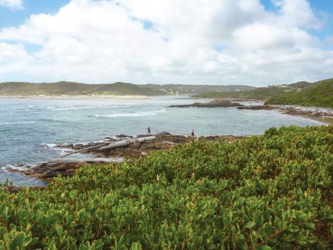
How’d it get the name? Built by larrikin surveyor and road-maker Len Beadell between 1955 and 1958 as part of the infrastructure for rocket testing at Woomera, the Gunbarrel Highway was the first east-west road link across Central Australia. Beadell was famous for making his roads as straight as possible (hence the name Gunbarrel). Why? Because he “didn’t want to make Australia untidy”.
What’s it really like? “Highway” is a misnomer – Beadell was known for his practical jokes – and even “track” is a grandiose name for the bone-shattering corrugations, deep ruts, rocks, tyre-impaling mulga stakes and bogholes that masquerade as a road. While it’s never been that straight, thanks to the terrain, long stretches did live up to the name originally but have developed kinks over the past half-century as off-roaders weave their way around the bad bits (pretty much all of it), trying not to get stuck. It’s the ultimate adventure drive through a harsh but sublimely beautiful desert landscape.
Not to be confused with: Road to Nowhere in Tasmania, Titwobble Lane in Wedderburn, Victoria, or Excellence Drive in Wangara, Western Australia.
Useless Loop
Shark Bay, Western Australia
Where is it? A 440-kilometre drive north of Geraldton.
How’d it get the name? It was tagged Havre Inutile (loosely meaning unusable harbour) in 1801 by French navigator Louis-Henri de Saulces de Freycinet. He described it as a “very pretty small harbour but which unfortunately, being closed in by a sandbank on which there is not more than three feet [90 centimetres] of water, can never admit a vessel of any size”. It officially became Useless when the French maps were translated in 1858.
What’s it really like? Far from useless, the mining town owned by Japan’s Mitsui Group produces 1.4 million tonnes of salt annually to ship to Asia. Although about 130 people call it home, it’s a company town off limits to travellers. Surrounded by Shark Bay World Heritage Area, the region’s highlights include the dolphins and dugongs of Monkey Mia, Shell Beach and Denham, Australia’s westernmost town.
Not to be confused with: Success, also in Western Australia, or Never Fail Dam in the Northern Territory.
Nowhere Else Road
Eyre Peninsula, South Australia
Where is it? The road starts in Sheringa, a 135-kilometre drive north of Port Lincoln.
How’d it get the name? According to local legend, some 19th-century shepherds were looking for a hut, without success. At the top of a hill, one frustrated man cried, “If it’s not over this hill, it’s nowhere else.” The hut was over the hill but the name stuck.
What’s it really like? There’s nowhere like Nowhere Else Road and nothing else exists there. “There are rocks and some limestone but no discotheques or anything like that,” says Scott Davies from Elliston Community and Visitor Information Centre, north of Sheringa. Finding the road can be tricky because its signage is favoured by souvenir hunters. “They kept being stolen,” says Davies, “so we started selling replicas at the visitor centre for $70 but they’re all gone, too.”
Not to be confused with: Nowhere Else in Tasmania (just down the road from the Promised Land) or Nowheres in Western Australia.
Foul Bay
Yorke Peninsula, South Australia
Where is it? About 130 kilometres (three-and-a-half hours’ drive) west of Adelaide.
How’d it get the name? Cruising past on his circumnavigation of the country in 1802, Matthew Flinders – who named much of Australia’s southern coast – maligned the shallow bay out of frustration because he couldn’t anchor his ship in the shifting sand, declaring it a “foul bay”.
What’s it really like? There’s nothing foul about Foul Bay’s golden 16-kilometre beach. It’s one of many attractions on the South Coast Road along the “sole” of the boot-shaped Yorke Peninsula, from Innes National Park in the west, past deserted bays, rocky inlets and historic lighthouses, to the cliff-top town of Edithburgh in the east. There’s seldom anyone here, apart from a few campers enjoying spectacular water views from places such as Mozzie Flat – named not for an insect plague but for the small, flat-bottomed trading ships, “the mosquito fleet”, that skimmed across these coastal waters in the mid-1800s.
Not to be confused with: Stinky Bay, also in South Australia, or Big Stinking Lagoon in the Northern Territory.
Come by Chance
Central West NSW
Where is it? 100 kilometres north-west of Coonamble.
How’d it get the name? Believing all the good farming land in the area to have already been snapped up by squatters in the 1860s, George and William Colless were so thrilled at being able to buy property they called it “Come by Chance”. The town was later named after their sheep station.
What’s it really like? Farming towns don’t get much quieter than Come By Chance, home to about 187 people on a good day, unless you’re there for the annual picnic races in September, when several thousand racegoers in the hope that their horse may just come, by chance, first.
Not to be confused with: Hard to Find Dam, Western Australia.
Valley of the Giants
South West Western Australia
Where is it? Walpole-Nornalup National Park, between Walpole and Denmark.
How’d it get the name? The Valley of the Giants is a unique tingle forest with trees that are up to 75 metres high, some with a circumference of 20 metres.
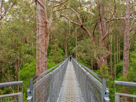
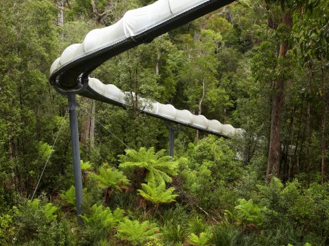
What’s it really like? The Valley of the Giants Tree Top Walk – a 600-metre-long steel walkway 40 metres above the forest floor – is one of the must-see attractions in WA’s south-west. If you don’t have a head for heights, the Ancient Empire Walk at ground level winds through a grove of 400-year-old tingle trees.
Not to be confused with: The Giants Den, NSW, or Giants Garden and Giants Stairway, both in Queensland.
Eggs and Bacon Bay
Huon Valley, Tasmania
Where is it? 60 kilometres south of Hobart.
How’d it get the name? There’s a bit of a myth that Lady Jane Franklin named it after her favourite breakfast, but it was actually named after a wildflower from the pea family, called the eggs and bacon flower, that carpets the shore of the bay in early summer.
What’s it really like? The pretty bay near the mouth of the Huon River is a popular fishing and camping spot. In 2016, animal rights group PETA campaigned to rename the area something a little more vegan, like Apple and Cherry Bay, although most of the locals are resisting the name change.
Not to be confused with: Sausage Gully and Onion Bay, both in Victoria, or Saucebottle Swamp, Queensland.
Nevertire
Central West NSW
Where is it? 20 kilometres south-west of Warren, 111 kilometres west of Dubbo.
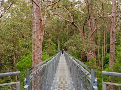
How’d it get the name? Surrounded by kilometres of flat plain in every direction, the Warren Historical Society says the name Nevertire was given to the tiny farming settlement because “the plain was so big that it went on, and on, and on, and it never tired”.
What’s it really like? Blink and you might miss Nevertire, which consists of some grain silos, half a dozen houses, a pub and not much else, although with so little interrupting the horizon, it does feel like you can see forever.
Not to be confused with: Nap Nap or Goodnight, both in NSW.
Break-Me-Neck Hill
Eastern Tasmania
Where is it? 65 kilometres north-east of Hobart.
How’d it get the name? It’s one of several steep sections on the road from Hobart to Orford that was tough work for the early east-coast settlers with their bullock drays laden with supplies.
What’s it really like? It’s still a steep and winding section of road, particularly if you are on a bicycle, but the advent of bitumen has made it a lot less perilous than it used to be.
Not to be confused with: Bust-Me-Gut Hill or Bust Me Gall, both in Tasmania.
Coffin Bay
Eyre Peninsula, South Australia
Where is it? 46 kilometres west of Port Lincoln.
How’d it get the name? Nothing to do with dead people, Coffin Bay was in fact named in 1802 by explorer Matthew Flinders in honour of Sir Isaac Coffin, who was alive and kicking at the time.
What’s it really like? The town of Coffin Bay, which is famous for its oysters, is adjacent to Coffin Bay National Park, which is just as famous for its deserted beaches, challenging 4WD tracks, great fishing and waterfront camping spots.
Not to be confused with: Diehard, NSW.
Paradise
North West Tasmania
Where is it? 35 kilometres south of Devonport.
How’d it get the name? According to the folk at Tourism Tasmania, Paradise, which was originally called Reuben Austen's Paradise, was named by one of the district’s first white settlers who, entranced by the sun glistening on nearby Mount Roland, remarked: “This is Paradise.”
What’s it really like? A locality made up of farms and a couple of holiday cottages rather than a town, Paradise is paradise for outdoor lovers, with some of Tasmania’s most magnificent mountain wilderness practically on its doorstep.
Not to be confused with: The Promised Land, NSW.
Poowong
South Gippsland, Victoria
Where is it? 95 kilometres south-east of Melbourne.
How’d it get the name? There’s quite a bit of conjecture about the origins of Poowong’s smirk-inducing name, but the consensus around town is that in the local Indigenous language it meant “six-foot long worm”, although some say it also meant “dead animals”.
What’s it really like? A pleasant dairy farming town with a population of around 700, Poowong hosted the world premiere of the comedy movie Kenny (about a toilet plumber), in 2006. The Sculpture Park is a lovely picnic spot.
Not to be confused with: Wee Creek, Victoria, or Innaloo, Western Australia.
Lovely Bottom
Southern Tasmania
Where is it? 47 kilometres east of Hobart.
How’d it get the name? There are lots of bottoms in Tasmania. A bottom – in geographical terms – derives from the Old English for broad river valley or valley floor.
What’s it really like? No-one seems to want Lovely Bottom as an address – it’s an uninhabited flat plain surrounded by forest and farmland just north of the Tasman Peninsula.
Not to be confused with: Prickly Bottom, Deep Bottom, Officers Bottom, Broad Bottom or the Butt of Liberty, all in Tasmania.
Yorkeys Knob
Far North Queensland
Where is it? 13 kilometres north of Cairns.
How’d it get the name? It’s named after George “Yorkey” Lawson, a fisherman originally from Yorkshire who built a homestead on the headland in the 1880s. The name might produce a few sniggers from visitors, but locals love telling the story of how a property developer was prevented from advertising the area as Yorkeys Beach. They proudly boast that their local slogan is “Yorkey's Knob, bigger than Moby’s Dick” – if you’re lucky you may still find it emblazoned on a souvenir t-shirt or stubby holder.
What’s it really like? A beach suburb of Cairns, Yorkeys is a popular holiday spot with waterfront apartments, marina and swimming area and a local golf course at Half Moon Bay with glorious views. It’s also a very good kite-surfing spot.
Not to be confused with: Blueys Knob or Shebas Breasts, both in Queensland.
This article was originally published in 2017 and has been updated.
SEE ALSO: 15 Things To Do On A Weekend in Goulburn
